The idea of this project is to use drones to fly along the most dangerous coastlines, taking live videos to help identify shapes in the water that could potentially be sharks or other dangerous things. Drones are great tools for video recording and data collection.Drones can be programmed to fly as hight as 500 miles up and return back to the station when needed. For the project prototype I fly a drone that took videos of serfers at Rockaway Beach.
Please see the video filmed on drone below:
The live video data would be reviewed by beach monitors that could mark the danger zones and alert safety workers like lifeguards to close sections of the beach. When drone detects a potential danger element in the water, it will change the LED color from green and yellow to bright red. People that are going to be in the water at that moment should be avare of the potential danger in the water and try to move to the safe zone.
The prototype of the video:
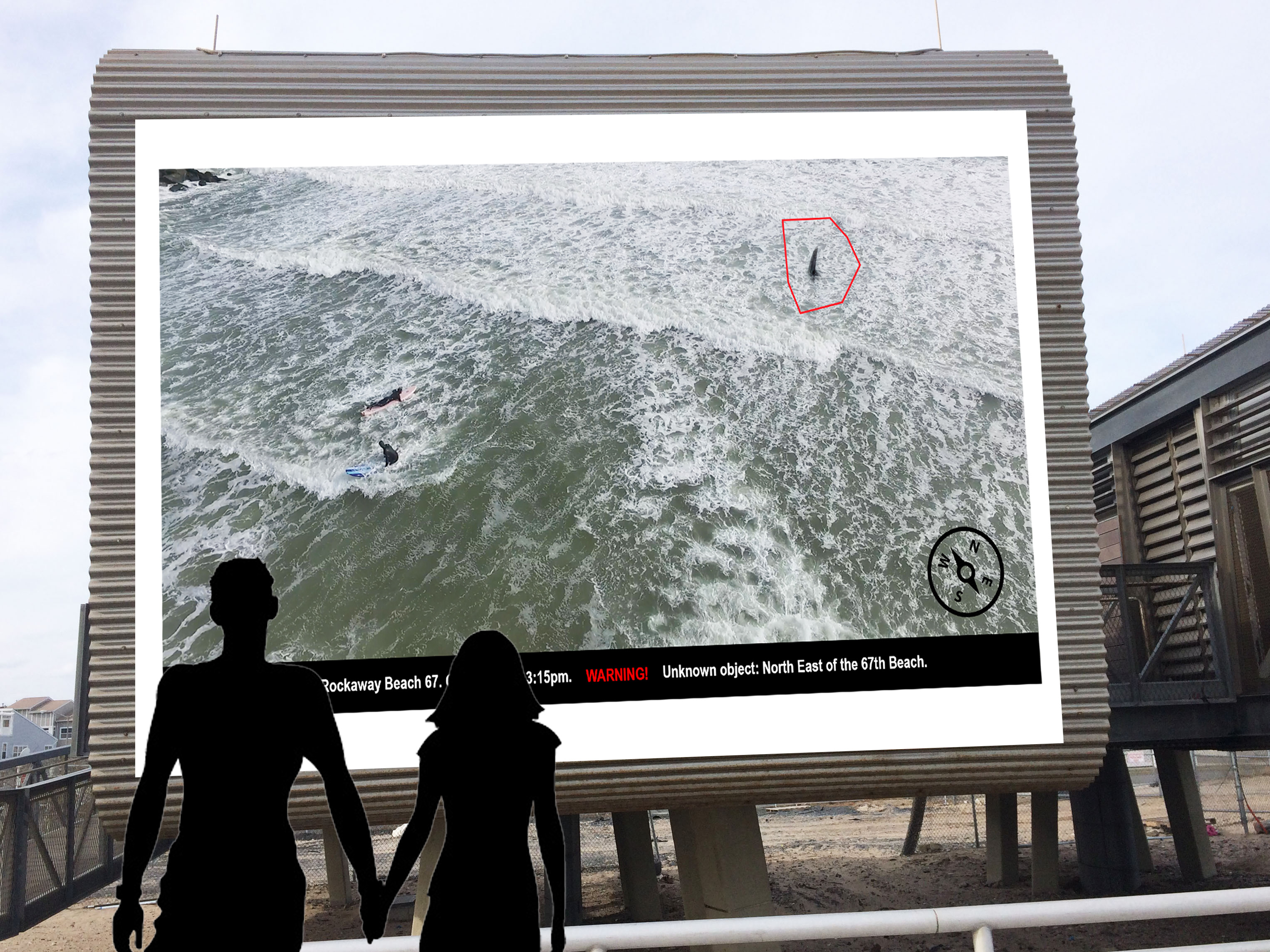
The results of the videos screening by drones will be projected on the big screen at the lifequards safe building. This option is going to be available for people who are not very familiar with technologies or prefer not to download any additional app to their phones.
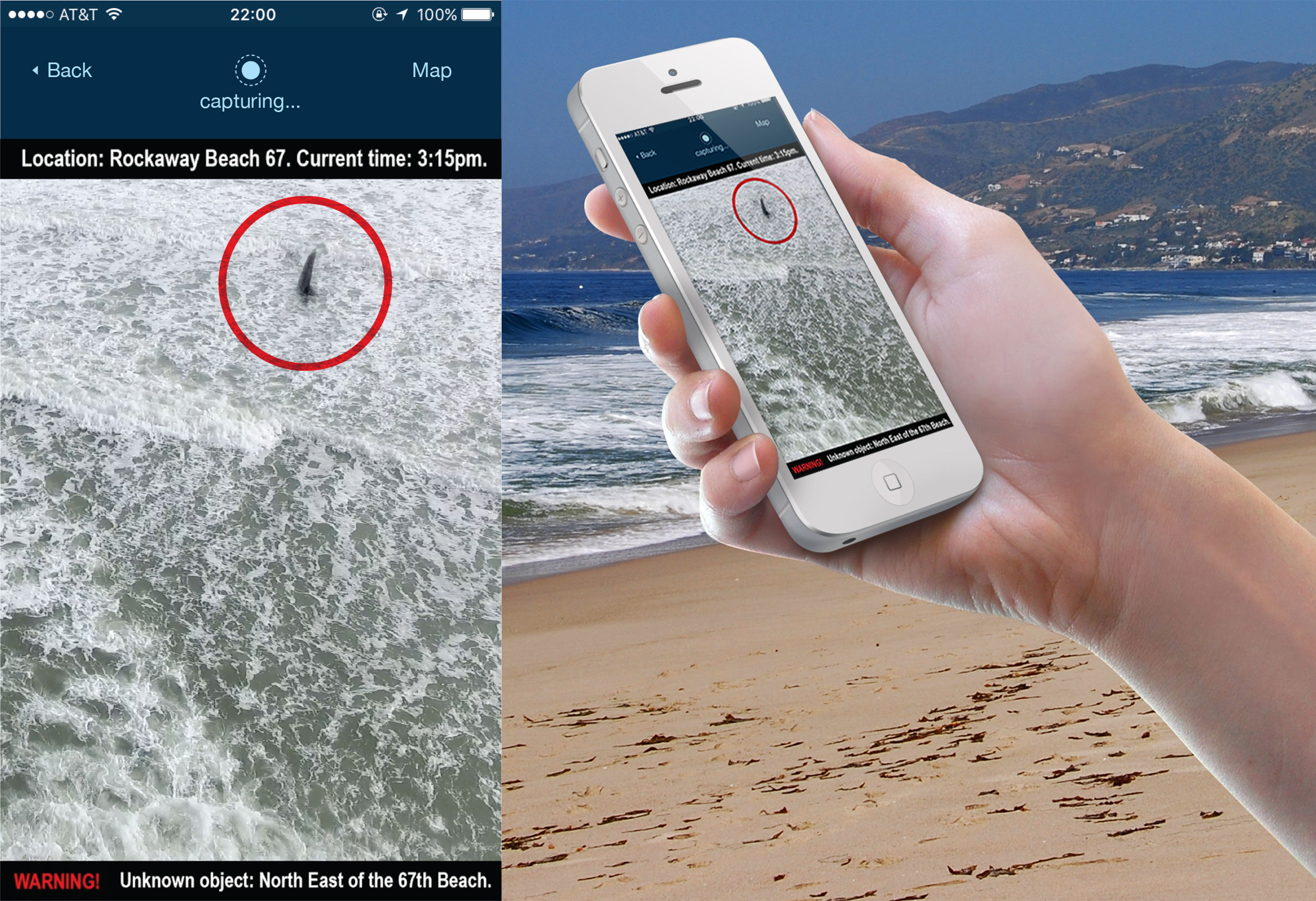
Another option to see the the stream video with data would be a mobile application. Technically savvy people who like any types of innovations will be able to download the app and use it in any location where drones are filming the surface.
Why?
I like the idea of having a great time on the beach and feel safe in the water. I would like to prevent potentially dangerous interactions between people at the beach and sharks or other unpleasant things in the ocean. I also would like to emprove the experience of spending time on the beach for people who are being afraid to get to the water, because of the potential danger.